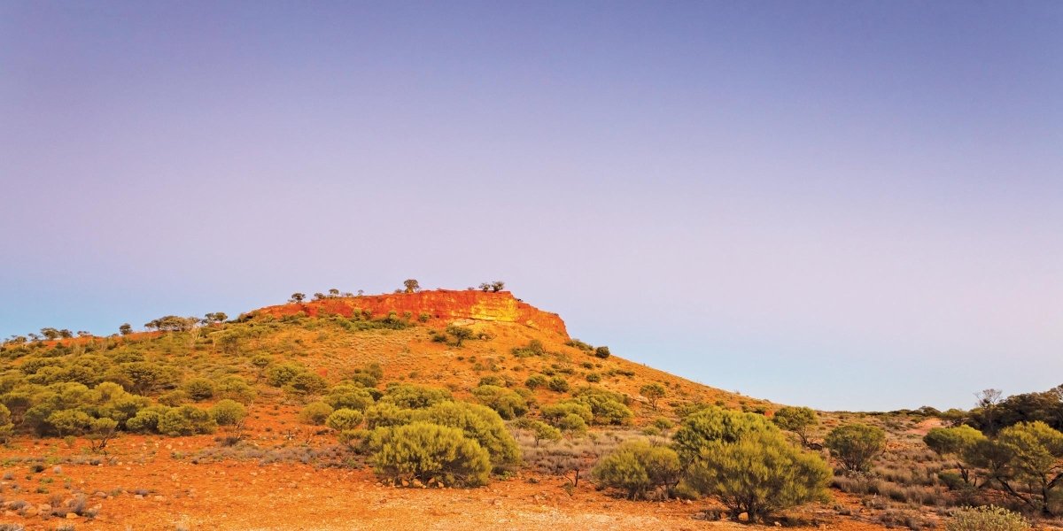

If you’re not confident in tackling endless corrugations and washaways, this so-called ‘highway’ isn’t for you.
The legendary Gunbarrel Highway is officially a gazetted highway, but certainly not in the true sense of the word … this is one of the most unrelenting 4WD tracks in Australia.
Hema Maps’ Great Desert Tracks Atlas & Guide warns: “Don’t make this your first desert adventure. This is an isolated desert track for experienced desert travellers only, and your vehicle needs to be tough. Only experienced four-wheel drivers with confidence in themselves and their vehicles should attempt this trip.” This is a true challenge of endurance in a very isolated part of Australia. Sure, you may encounter other four-wheel drivers during your travels. But you may not.

Gunbarrel’s origins
The Gunbarrel Highway was the first road constructed by Len Beadell and his road crew who together comprised The Gunbarrel Road Construction Party.
Its origins date back to 1946–47, to the Anglo-Australia Joint Project under which the Woomera Prohibited Area was declared and the Woomera Range Complex established. After serving in the Second Australian Imperial Force (with the 2nd and 8th Field Survey and the 6th Topographical Survey Companies) during World War II, Len Beadell commenced a survey of what is today known as the Woomera Range Complex, including the Woomera Test Range. He was discharged from the Australian Regular Army in 1948. In 1950 he joined the then Long Range Weapons Establishment in Salisbury, South Australia, and undertook mapping of the rocket range and surveyed sites for Observation Posts (OPs) along the firing line. He and his GRCP team established a network of tracks to link the OPs and meteorological stations. Beadell wanted to build roads that were as straight as a gun barrel.
The best time of year to drive this route is May to September to avoid the relentless heat from October to April.
Access and permits

The original Gunbarrel Highway is no longer navigable by the public for the entirety of Beadell’s route. The Old Gunbarrel Highway that runs between Warburton and Warakurna is nowadays considered by the Ngaanyatjarra Council to be, “Abandoned Section of Gunbarrel (NOT OPEN TO PUBLIC)”. It may be possible to obtain a permit from Ngaanyatjarra Council for this section, on a “special conditions basis”, however unlike transit permits for Great Central Road, Ngaanyatjarra Southern Road, Sandy Blight Junction Road, Gunbarrel Highway, Giles Mulga Park Road, Connie Sue Highway and Heather Highway, the abandoned section is not listed as “Automatic Approval”.
And the South Australian section from the Northern Territory–South Australia border near Mulga Park Homestead all the way to the South Australia–Western Australia border between Kalka and Wingellina (Irrunytju) is off-limits since it crosses Anangu Pitjantjatjara Yankunytjatjara (APY) Lands.
Mulga Park Road was originally part of the Gunbarrel Highway, for its section between Mulga Park Homestead and Victory Downs Station. If you want to drive this Mulga Park Road section, you can access it from either the Stuart Highway just north of the ‘Welcome to the Northern Territory’ sign at the SA–NT border, or from the Lasseter Highway near Curtin Springs Station.
Transit permits for the 830km section of the Gunbarrel Highway between Wiluna and Warburton and Great Central Road in Western Australia require two application forms to be lodged. One can be obtained from Ngaanyatjarra Council and the other from Government of Western Australia’s Department of Planning, Land and Heritage . The Ngaanyatjarra Council permits also have information about travelling safely and relevant by-laws.
If continuing onto Yulara and Uluṟu-Kata Tjuṯa National Park in Central Australia from Warburton via Kaltukatjara on the Great Central Road, you’ll also need a permit from the Northern Territory’s Central Land Council .
Before departing from Wiluna (‘Gateway to the Canning Stock Route and Gunbarrel Highway’), be sure to seek road conditions information for the Shire of Wiluna online here , email reception@wiluna.wa.gov.au or telephone 08 9981 8000.

Be prepared
Be prepared. You will need to be 100 per cent self-sufficient for most of this journey. That means communications equipment ( UHF radios and satellite comms ), personal locator beacon (PLB), spare parts for your low-range, high-clearance 4WD and stocking up on food, fuel and water. And a really good map:
This is a bush camping trip, pure and simple. There are no hotels or network/chain caravan parks out here. You will need to seek and obtain property owners’ permission to camp in many instances.
Carnegie Station is 339km from Wiluna. There are no fuel outlets along this stretch, until you get to Carnegie Station which has limited supplies of fuel available for purchase. The station also has a general store selling basic provisions and offers a camp kitchen, basic shower facilities, donga accommodation and shaded, unpowered camping sites for tents, swags and offroad camper trailers and caravans. Email carnegiestation@gmail.com or phone 08 9981 2991 to get the latest updates.
There are around 12 wells or bores marked by Hema Maps between Wiluna and Carnegie Station, however it is recommended that you do not rely on this water. Carry all your water for your drinking, washing and cooking needs.
En route, take advantage of rest areas (Wongawol Creek and Harry Johnson Water [nicknamed Mingol Camp]), not only for you and your travelling companions, but for your vehicle/s as well.
Near Carnegie there is a road sign which reads “Gunbarrel Highway. Last stop for water, fuel and supplies. Next service is 500km at Warburton. There is no water or other facilities until then. Road conditions will vary greatly. Motorists are advised to exercise caution on the Gunbarrel Highway.”
That sign pretty much sums it all up.
Once you’ve departed Carnegie Station the Gunbarrel Highway narrows significantly, and areas of potentially boggy conditions become more frequent. This is a tough haul to Warburton. The Mangkili Claypan Nature Reserve at the T-junction with David Carnegie Road (formerly Eagle Highway) is as good a place as any to stop for lunch and brew up a cuppa. There can be water in the claypan at any time of year.
The erstwhile, eponymous Eagle Highway was named after the Eagle Oil Company but renamed in 1996 to mark the centenary of explorer David Wynford Carnegie’s 1896 exploration which approximated the route of the ‘road’. Lake Carnegie was also named after the explorer, as was Carnegie Station.
You’ll be able to identify Geraldton Bore camping spot (at the intersection with the old turnoff to Hunt Oil Road) from a distance thanks to its telltale trees. Just because there are trees here though, doesn’t mean that there will be firewood beneath them. Ensure to bring firewood along with you, for the fireplace. There is water in the bore and in this instance, travellers are welcome to obtain it. Since it’s a bore rather than a well, 20m of rope is advisable, as is a vessel more akin to a billy than a bucket.
At Everard Junction, the Gary Highway heads northwards through the Pila Nature Reserve (Gibson Desert), 325km to Gary Junction. Gary Highway was also constructed by Len Beadell and his GRCP.
Onwards to another free campsite at Camp Beadell and a few kilometres thereafter to Mt Beadell, atop which is a replica of Len Beadell’s theodolite and a memorial to him.
There should be water at Thryptomene Hill bore. It is signposted “Water / Kapi” (“kapi” means “water” in Luritja and other western desert languages) and there is a pump.
From here, it’s just a hop, skip and a jump (relatively speaking!) to the Heather Highway and Great Central Road into Warburton where a sight for sore eyes, Warburton Roadhouse, has accommodation (donga-style accommodation, cabins, caravan and camping sites), fuel (diesel and Opal fuel) and general store where you should be able to buy your first fresh bread, fruit and veg and ice cream for a few days. Note that alcohol is not permitted when staying at Warburton Roadhouse.

Len’s legacy
Was Len Beadell the first person to explore this remote country? Certainly not. We know that First Nations Australians have been living in Australia’s arid interior for tens of thousands of years.
And we know that Peter Egerton Warburton travelled from Alice Springs to Perth in 1873, traversing the Gibson Desert and Little Sandy Desert.
John Forrest successfully crossed the desert country from Geraldton to the Warburton Ranges in 1874 (and onwards to the Overland Telegraph Line).
The Elder Scientific Expedition led by Lawrence Allen Wells and David Lindsay crossed the western deserts from east to west in 1891.
David Wynford Carnegie crossed the western deserts from south to north in 1896–97.
But was Len Beadell OAM BEM FIEMS the last of the great desert explorers?
Yes. And along the Gunbarrel Highway, Gary Highway, Anne Beadell Highway, Connie Sue Highway, Sandy Blight Junction Road, Gary Junction Road, Talawana Track (and more), his legacy lives on.


