
In the second ‘deep dive’ in our dry season touring series, we look at the top tips for a trip to the Top End.
Depending on who you talk with and what you read, the Northern Territory has two seasons: the ‘wet’ and the ‘dry’.
There is no specific date that the Top End dry season begins, so let’s take a leaf out of the Bininj/Mungguy Traditional Owners’ book and include three of their six seasons in Kakadu in our ‘definition’ of the dry. These are Yekke (May to mid-June), Wurrkeng (mid-June to mid-August) and Kurrung (mid-August until mid-October).
Late April seems to herald the end of the wet and the advent of the dry making it the ideal time of the year to drive to the Top End.
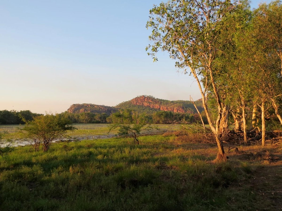
It’s a time of the year characterised by lower humidity, clear skies, dry and warm sunny days and cooler (albeit still balmy!) evenings. The dry is also the most popular season. If you have school-aged kids, it makes the world of sense to capitalise on the July school holidays for your Top End touring. If you are travelling without school-aged kids and are not constrained by school holiday dates, our recommendation is to visit in the shoulder months, being May or September.

Image credit: Robert Crack
The dry is also the perfect time for outdoor activities such as camping, cycling and bushwalking, and the time of the year when more national park waterholes are open for swimming. As a bonus, the Top End’s events calendar is in full swing, with the Darwin Aboriginal Art Fair, Darwin Festival, Darwin Lions Beer Can Regatta, Great Northern Darwin Cup, Garma Festival, betr Darwin Triple Crown (V8 Supercars) and the Barunga Festival all taking place during the dry season, and Darwin’s Mindil Beach Sunset Market and Deckchair Cinema also operating.

Image credit: Robert Crack
Whether you are driving to the Top End via the Savannah Way, Overlanders Way, Outback Way or Explorers Way (or a combination thereof), a self-drive trip to the Top End is one of the greatest Australian road trips. It’s ruggedly beautiful. There’s Aboriginal history, culture and art in spades. There’s the history of the Overland Telegraph, the Afghan cameleers and The Ghan railway. There’s the Indigenous Australian history of exploration as well as the European exploration history, and that’s partially why the route from Adelaide to Darwin is marketed internationally as the Explorers Way.
A lot of Australians know the road from Port Augusta to Darwin as the Stuart Highway, but to international visitors from the likes of Germany, Switzerland, France, Italy, the Netherlands and the UK, it is known as the Explorers Way because it pretty much follows the route/s of the explorer, John McDouall Stuart.
At 2,720km from Port Augusta to Darwin, the Stuart Highway is the second-longest road in Australia (not counting Highway 1 which is in fact a network of roads, not a single road), second only in distance to the Great Northern Highway in Western Australia.
Australia’s second-longest road (and the side trips to iconic places of interest en route in the Red Centre, Kimberley or Gulf Savannah country) requires some preparation. Here at A247 Gear we are staunch believers in being prepared for any situation, whether expected or unexpected. This preparation includes carrying what we consider to be essential items. As mentioned in Heading north for the dry season: how to prepare, here at A247 we recommend four preparation categories: vehicle, permit, route and accommodation (book ahead when practicable).

Image credit: Robert Crack
Vehicle preparation
Make sure that your touring vehicle (and accompanying caravan, camper trailer, etc.) is suited to the route you’ll be travelling and know the capabilities of everything on wheels. While the Stuart Highway, Barkly Highway and Victoria Highway are all sealed, there are plenty of side trips beyond the bitumen that warrant a low range, high clearance four-wheel drive vehicle.
Know your vehicle’s fuel consumption under the weather conditions, road gradients and road surfaces you expect to encounter, and map out service stations and roadhouses in advance. As long as you plan ahead and appreciate that the Stuart Highway isn’t lined with 24-hour Roadhouses you’ll be fine. Alternatively, simply fill up at every service station when you feel it to be opportune to do so.
Be prepared for any emergency. Make sure your spare tyre is also in good condition and know how to change it. Check your wheel nuts every morning after driving on dirt the day before. If going offroad, give your spare tyre another spare tyre for company; they enjoy travelling in pairs!
Permits
A number of regions (including Arnhem Land) and national parks in the Top End require permits to enter. This is usually due to the unique protected environment you are entering and/or the Aboriginal ownership of particular areas. Some areas are extremely culturally sensitive to their Traditional Owners, and these are usually off limits to all tourists unless you have special permission, which is often unattainable for touring applications.
If you're a visitor to the Northern Territory, you require an NT Parks Pass to visit most national parks and reserves. These include (but are not limited to) Butterfly Gorge Nature Park, Mary River National Park, Elsey National Park, Fogg Dam Conservation Reserve, Limmen National Park, Litchfield National Park, Judbarra / Gregory National Park, Nitmiluk (Katherine Gorge) National Park and Umbrawarra Gorge Nature Park. Note that the NT Parks Pass can’t be used to enter Kakadu National Park; unless you are an NT resident with a valid NT driver licence, you will need to purchase a park pass from the Parks Australia website.

Image credit: Robert Crack
Route
Despite it being the ‘dry’ rather than the ‘wet’, roads can nonetheless be closed or under repair. So be sure to check your intended route/s before you leave home, and also during your journey. Council websites are a good source of road condition information in the more remote shires (particularly relating to local roads maintained by local government), and each State and Territory has regularly updated online content which cover road conditions and closures:
Northern Territory: https://roadreport.nt.gov.au/home
Queensland: https://qldtraffic.qld.gov.au/
Western Australia: https://travelmap.mainroads.wa.gov.au/
South Australia: https://www.traffic.sa.gov.au/

Image credit: Robert Crack
Accommodation
In the peak of the dry season, accommodation facilities can often be solidly booked, so it’s a good idea to pre-book your hotel room, motel room, donga, caravan park site / cabin or camping site in advance, especially in those locations through which you know you will be driving.
Car/camping equipment
Take what you would normally take on a camping trip in the way of tools, equipment and personal items but consider the following:
Jerry cans with extra fuel and water — plan your mileage and fuel stops along the way and not all places selling fuel are open 24/7
Extra spare tyre or at least a tyre repair kit and spare valves
A two-way radio is essential for communicating with other drivers on the road
Tyre gauge and compressor to deflate/inflate your tyres to drive on gravel or sand
Recovery boards, such as MAXTRAX , to get you out of sticky/sandy situations if you get bogged
Recovery kit, such as Saber
First aid kit including a snake bite kit
A flynet for your hat
Insect repellent
Collared long-sleeve shirts e.g. fishing shirts
Reef walker shoes for gorge / waterhole swimming
Decent hiking shoes / boots
To facilitate ‘checking in’ with friends or family when solo travelling, know in advance where wi-fi locations are, particularly in remote areas of the Northern Territory, Western Australia, Queensland, South Australia and outback NSW. For example, there are more than 25 free public wi-fi locations in the Northern Territory, courtesy of Tourism NT. These include Watarrka National Park, Wangi Falls (Litchfield National Park), Karlu Karlu / Devils Marbles, Timber Creek, Tennant Creek Visitor Information Centre and Hermannsburg.
The Top End in the dry season is a place so abundant in natural beauty that more travellers take photos of landscapes, waterfalls, waterholes and sunsets than photos of themselves in front of landscapes, waterfalls, waterholes and sunsets.
Now, that’s my kind of place!

Image credit: Robert Crack


